Log in
All resources
Create a design
9,296 Free Artworks of Map Collection
bibliothèque nationale de france
british library
copper engraving print
joan blaeu
mappa geographica novissima regni hungariae, - divisi in suos comitatus cum districtibus jazygum et cumanorum banatus temesiensis ejusque districtuum nec non regnorum croatiae sclavoniae dalmatiae magni... - btv1b532332906
tranquillo mollo
1667 maps
national library of poland
island of california
civitates orbis terrarvm, liber primvs (1577)
maps in the stadsarchief amsterdam
romeyn de hooghe
1660s maps of taiwan
1667 maps
old maps of farmakonisi
old maps of agathonisi
maps by guillaume sanson
old maps of friesland
the british monarchy (1743)
maps in the british museum
maps by jean-baptiste bourguignon d'anville
1727 maps of africa
sanson maps of the netherlands
1680s maps of the netherlands
map of the upper rhenian circle by sanson
1670s maps of hesse
map of the upper rhenian circle by sanson
1700s maps of north rhine-westphalia
maps of the islands of greece by marco boschini (1658)
old maps of the peloponnese
maps of los palacios by braun & hogenberg
maps of las cabezas by braun & hogenberg
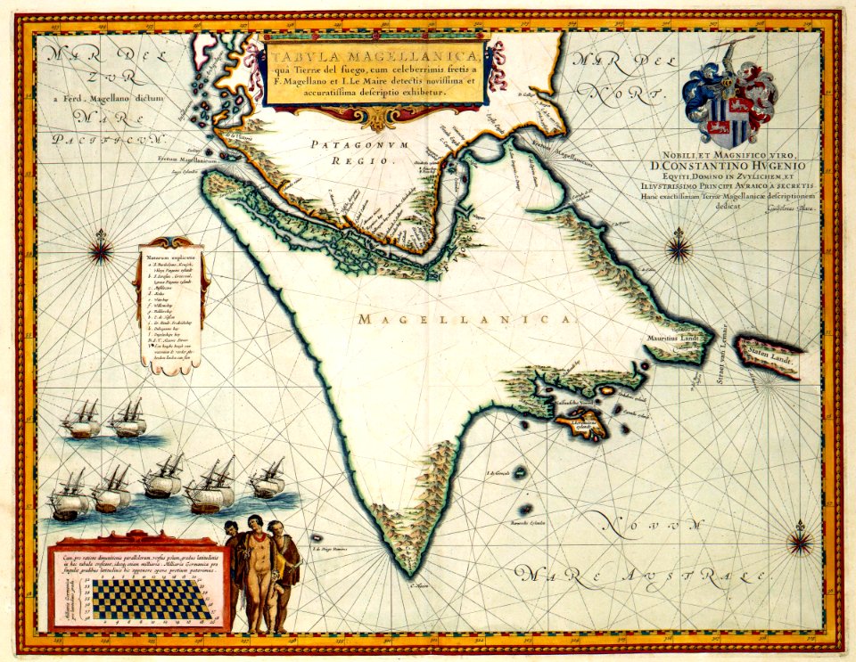
17th-century maps of the strait of magellan
1668 maps of south america
1780s maps of tunisia
1780s maps of libya
1698 map of evesché de meaux
robert cordier (engraver)
18th-century oil portraits of standing women at full length
andreas brugger
mappa geographica novissima regni hungariae, - divisi in suos comitatus cum districtibus jazygum et cumanorum banatus temesiensis ejusque districtuum nec non regnorum croatiae sclavoniae dalmatiae magni... - btv1b532332906
tranquillo mollo
mappa geographica novissima regni hungariae, - divisi in suos comitatus cum districtibus jazygum et cumanorum banatus temesiensis ejusque districtuum nec non regnorum croatiae sclavoniae dalmatiae magni... - btv1b532332906
tranquillo mollo
mappa geographica novissima regni hungariae, - divisi in suos comitatus cum districtibus jazygum et cumanorum banatus temesiensis ejusque districtuum nec non regnorum croatiae sclavoniae dalmatiae magni... - btv1b532332906
tranquillo mollo
mappa geographica novissima regni hungariae, - divisi in suos comitatus cum districtibus jazygum et cumanorum banatus temesiensis ejusque districtuum nec non regnorum croatiae sclavoniae dalmatiae magni... - btv1b532332906
tranquillo mollo
mappa geographica novissima regni hungariae, - divisi in suos comitatus cum districtibus jazygum et cumanorum banatus temesiensis ejusque districtuum nec non regnorum croatiae sclavoniae dalmatiae magni... - btv1b532332906
tranquillo mollo
mappa geographica novissima regni hungariae, - divisi in suos comitatus cum districtibus jazygum et cumanorum banatus temesiensis ejusque districtuum nec non regnorum croatiae sclavoniae dalmatiae magni... - btv1b532332906
tranquillo mollo
mappa geographica novissima regni hungariae, - divisi in suos comitatus cum districtibus jazygum et cumanorum banatus temesiensis ejusque districtuum nec non regnorum croatiae sclavoniae dalmatiae magni... - btv1b532332906
tranquillo mollo
mappa geographica novissima regni hungariae, - divisi in suos comitatus cum districtibus jazygum et cumanorum banatus temesiensis ejusque districtuum nec non regnorum croatiae sclavoniae dalmatiae magni... - btv1b532332906
tranquillo mollo
mappa geographica novissima regni hungariae, - divisi in suos comitatus cum districtibus jazygum et cumanorum banatus temesiensis ejusque districtuum nec non regnorum croatiae sclavoniae dalmatiae magni... - btv1b532332906
tranquillo mollo
mappa geographica novissima regni hungariae, - divisi in suos comitatus cum districtibus jazygum et cumanorum banatus temesiensis ejusque districtuum nec non regnorum croatiae sclavoniae dalmatiae magni... - btv1b532332906
tranquillo mollo
mappa geographica novissima regni hungariae, - divisi in suos comitatus cum districtibus jazygum et cumanorum banatus temesiensis ejusque districtuum nec non regnorum croatiae sclavoniae dalmatiae magni... - btv1b532332906
tranquillo mollo
arnold van langren map of east africa
1600 maps of africa
maps by pieter van der keere
17th-century maps of silesia
bibliothèque nationale de france
maps by thomas kitchin
john rocque's 1748 map of london and adjacent country
bibliothèque nationale de france
maps of hamburg by braun & hogenberg
maps of lübeck by braun & hogenberg
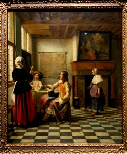
baroque,dutch golden age painting
paintings by pieter de hooch
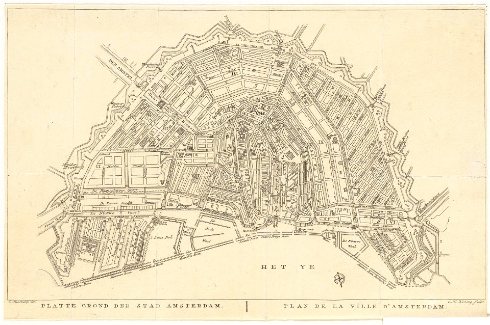
old maps of amsterdam
evert maaskamp
maps of the west-indische compagnie
1770 maps
prints by oluf olufsen bagge in the statens museum for kunst
engraving
maps by gerard valck
pieter schenk (i)
maps of diu by braun & hogenberg
diu, india
eran laor cartographic collection
claes jansz. visscher (ii)
british library - off the map alice collection - wonderland
british library - off the map alice collection
johann baptist seele
realism
atlas van der hagen (volume 4)
people with animals in art
old maps of atlantis
island of california
1762 maps of north america
maps by tomas lopez
carte de la mer méditerranée en trois feuilles (dheulland et al.)
18th-century maps of the western mediterranean
maps of paris by braun & hogenberg
maps in the british museum
17th-century maps of xaintonge
maps by jodocus hondius ii
carte de la mer méditerranée en trois feuilles (dheulland et al.)
18th-century maps of the eastern mediterranean
1777 maps of south america
maps by thomas kitchin
maps by pieter mortier
maps from gallica
maps by pieter mortier
maps from gallica
egypt by david roberts
orientalism
carte de la mer méditerranée en trois feuilles (dheulland et al.)
old maps of the central mediterranean
maps by alexis-hubert jaillot
old maps of duchy of cleves
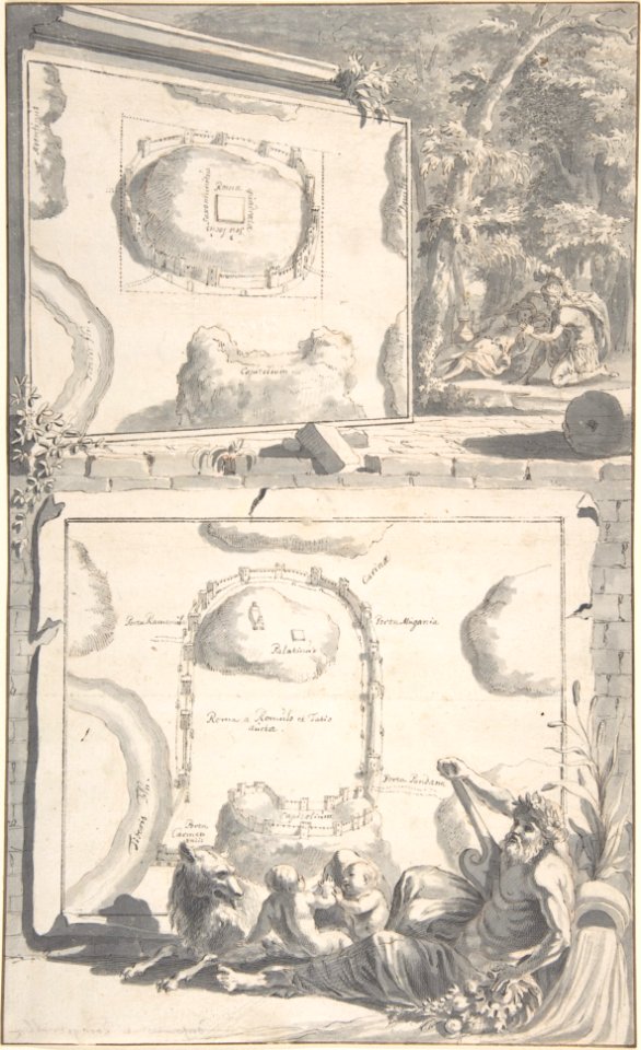
engravings of rome
jan goeree
illustrations
guy arnoux
landais & oberthur
maps from gallica
17th-century maps of tartary
17th-century maps of siberia
atlas minor gerardi mercatoris (1609)
maps of asia by mercator-hondius
civitates orbis terrarvm, liber primvs (1577)
maps of groningen by braun & hogenberg
chorographia britanniae (1741-1742)
18th-century maps of sussex
civitates orbis terrarvm, liber primvs (1577)
maps of tours by braun & hogenberg
civitates orbis terrarvm, liber primvs (1577)
maps of rouen by braun & hogenberg
panoramic maps of seville by braun & hogenberg
civitates orbis terrarvm, liber primvs (1577)
civitates orbis terrarvm, liber primvs (1577)
maps of heidelberg by braun & hogenberg
maps of münster (westfalen) by braun & hogenberg
civitates orbis terrarvm, liber primvs (1577)
plans of castles of japan
hyogo castle
paintings in the walker art gallery, liverpool
charles napier hemy
zur geschichte der kartographie nordalbaniens (map reconstructions)
coding da vinci: süd 2019
everett d. graff collection of western americana
st. louis, missouri in the 1800s
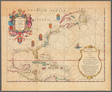
1620s maps of north america
1620s maps of the caribbean
construction drawings in the stadsarchief amsterdam
daniel stoopendaal
maps in the stadsarchief amsterdam
prints by dirk jurriaan sluyter
sanson maps of north america
1674 maps of north america
sanson maps of north america
island of california
sanson maps of north america
island of california
sanson maps of north america
island of california
sanson maps of north america
island of california
sanson maps of north america
island of california
antoine-françois tardieu
maps from gallica
atlas ou representation du monde universel t. 2 (1633)
17th-century maps of southeast asia
old maps of le tréport
maps from gallica
civitates orbis terrarum. de praecipuis totius universi urbibus. liber secundus
maps of dunkerque by braun & hogenberg
civitates orbis terrarum. de praecipuis totius universi urbibus. liber secundus
maps of tunis by braun & hogenberg
civitates orbis terrarum. de praecipuis totius universi urbibus. liber secundus
maps of šibenik by braun & hogenberg
maps by jakob van der schley
old maps of stralsund
maps in the british museum
prints by albert flamen
jacob le maire
1635 maps
atlas maior, vol 4 (netherlands) - joan blaeu, 1667 - bl 114.h(star).4
1667 maps
atlas maior, vol 2 (sweden, russia, poland, eastern europe, and greece) - joan blaeu, 1667 - bl 114.h(star).2
17th-century maps of the aegean sea
atlas maior, vol 1 (northern europe, norway, and denmark) - joan blaeu, 1667 - bl 114.h(star).1
1667 maps
atlas maior, vol 8 (france ii and switzerland) - joan blaeu, 1667 - bl 114.h(star).8
1667 maps
atlas maior, vol 7 (france i) - joan blaeu, 1667 - bl 114.h(star).7
1667 maps
atlas maior, vol 1 (northern europe, norway, and denmark) - joan blaeu, 1667 - bl 114.h(star).1
1667 maps
atlas maior, vol 1 (northern europe, norway, and denmark) - joan blaeu, 1667 - bl 114.h(star).1
1667 maps
atlas maior, vol 2 (sweden, russia, poland, eastern europe, and greece) - joan blaeu, 1667 - bl 114.h(star).2
17th-century maps of poland
atlas maior, vol 8 (france ii and switzerland) - joan blaeu, 1667 - bl 114.h(star).8
1667 maps
atlas maior, vol 3 (germany) - joan blaeu, 1667 - bl 114.h(star).3
old maps of upper austria
atlas maior, vol 1 (northern europe, norway, and denmark) - joan blaeu, 1667 - bl 114.h(star).1
1667 maps
atlas maior, vol 2 (sweden, russia, poland, eastern europe, and greece) - joan blaeu, 1667 - bl 114.h(star).2
1667 maps of russia
atlas maior, vol 4 (netherlands) - joan blaeu, 1667 - bl 114.h(star).4
1667 maps
4201 - 4300 of 9,296
Next page
/ 93